Log in
All resources
Create a design
863,826 Free Images of Maps By Coronelli
maps in the library of congress
david rumsey historical map collection
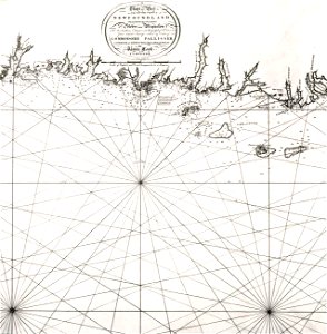
hand-drawn maps and views of world war i battlefields by h.m.
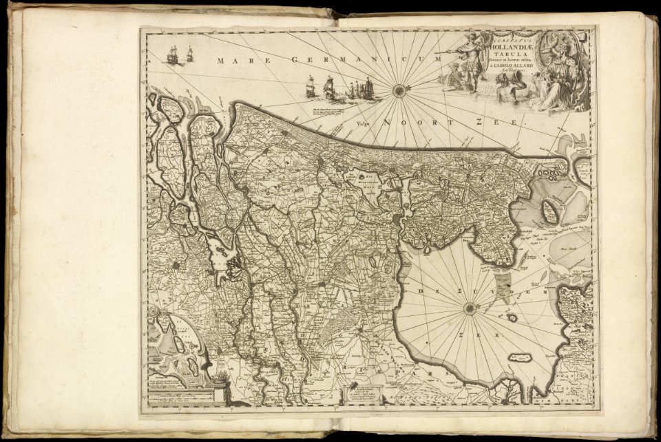
carolus allard
maps made in the 17th century
maps in the stadsarchief amsterdam
western front maps of world war i
maps with cartouches
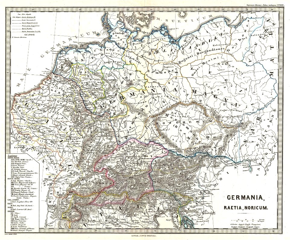
german-language maps
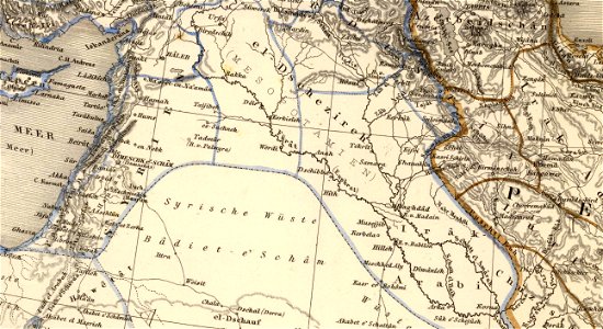
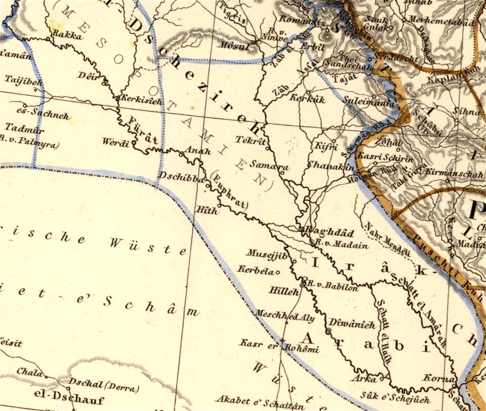
old maps of mesopotamia
fonds ancely - bibliothèque municipale de toulouse - maps
19th-century maps of france
maps in the library of congress
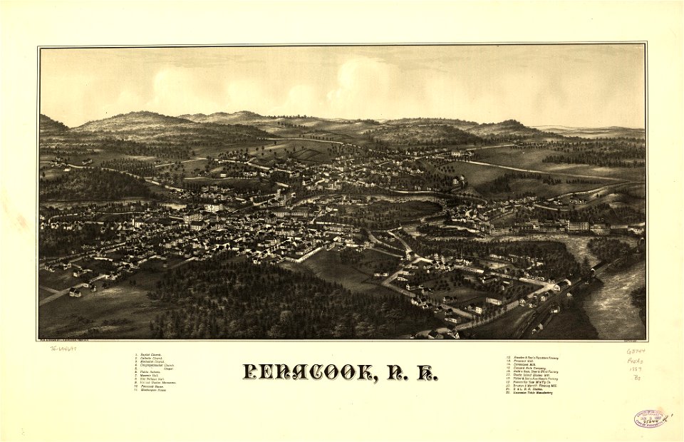
old maps of new hampshire
maps in the library of congress
old maps of new hampshire
maps in the library of congress
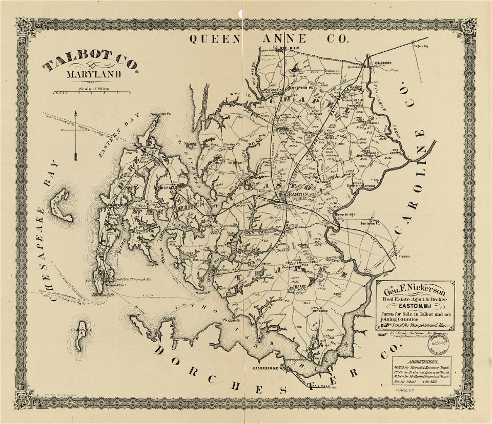
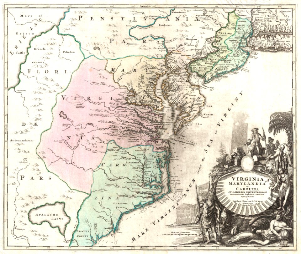
old maps of maryland
maps in the library of congress
old maps of maryland
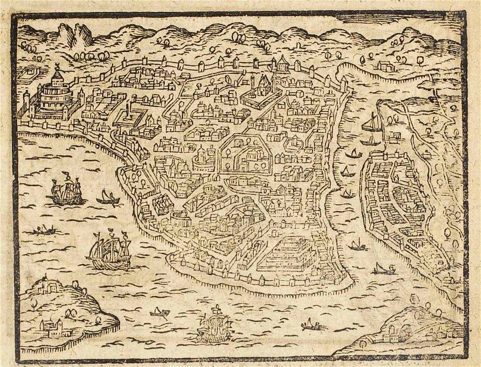
old maps of istanbul
ships on maps
maps in the library of congress
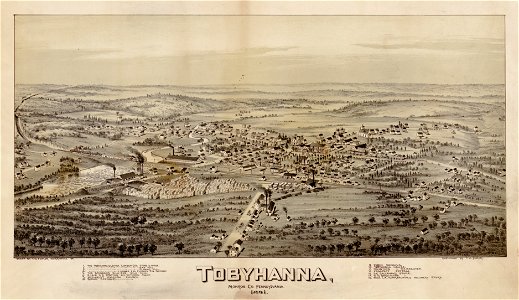
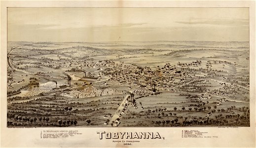
pennsylvania
maps in the library of congress
pennsylvania
17th-century maps of finland
17th-century maps of estonia
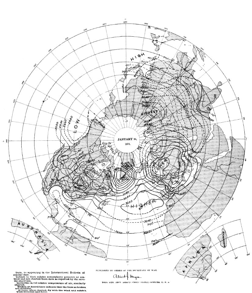
old weather and climate maps
1880 maps
london
1841
old maps of poland
1865 maps
travels in sicily greece and albania
old maps of greece
18th-century maps of north carolina
north carolina
clothing of russia
ships on maps
old maps of the arabian peninsula
maps of midian
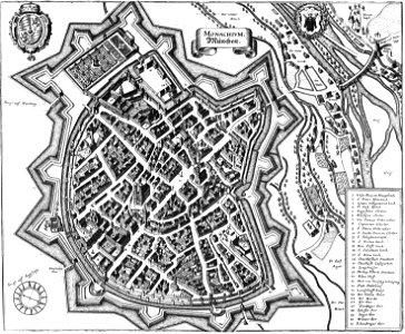
innere stadt
vienna
david rumsey historical map collection
fur garments in art
maps of reading abbey
reading
volume 3 of le tour du monde
maps by alexandre vuillemin
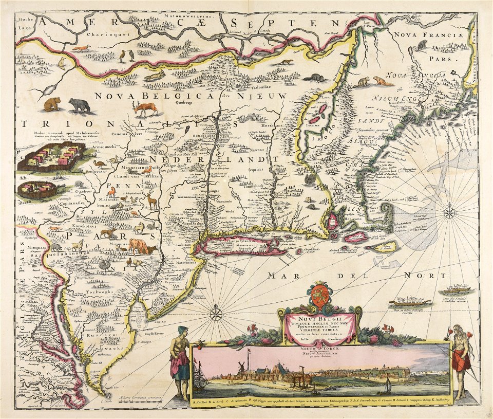
maps by willem and johannes blaeu
maps made in the 17th century
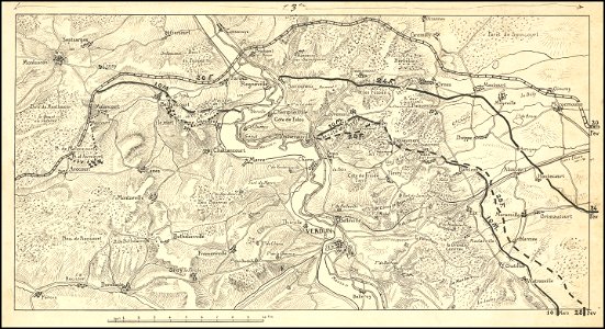
hand-drawn maps and views of world war i battlefields by h.m.
western front maps of world war i
hand-drawn maps and views of world war i battlefields by h.m.
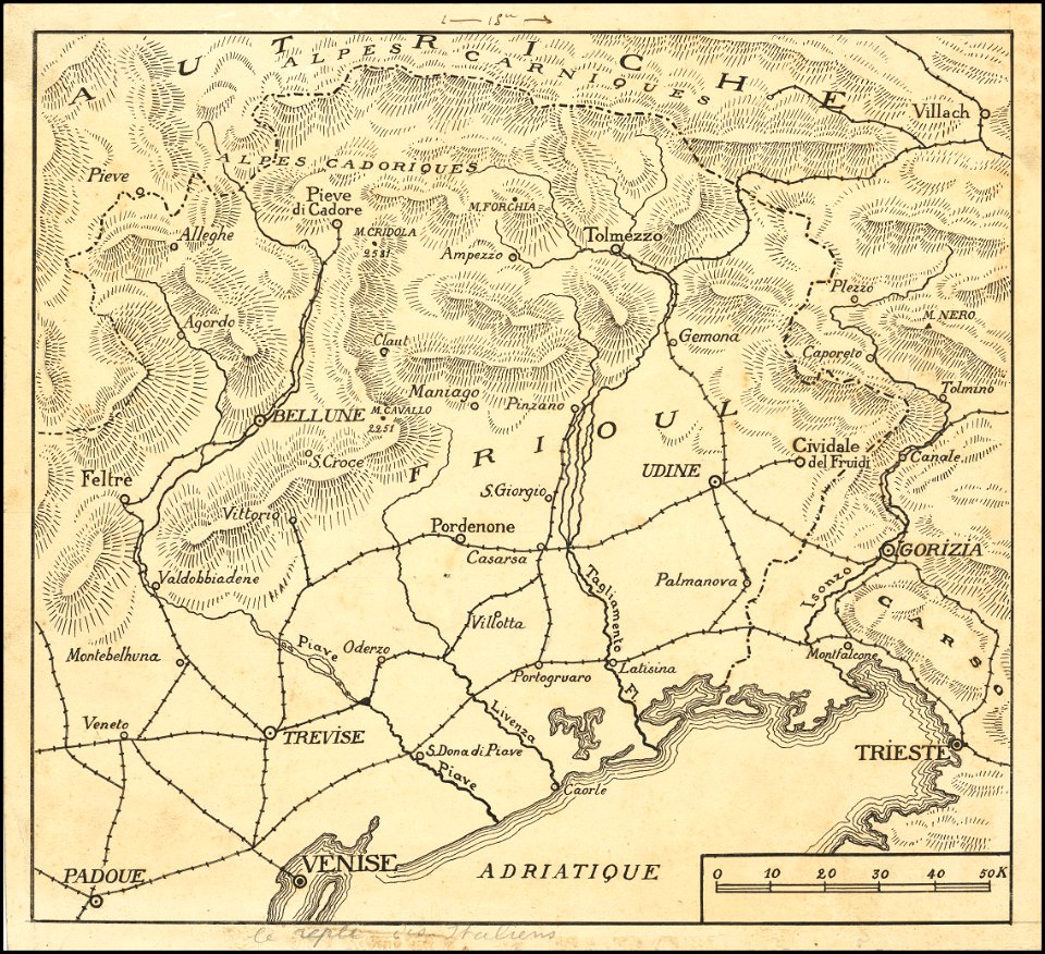
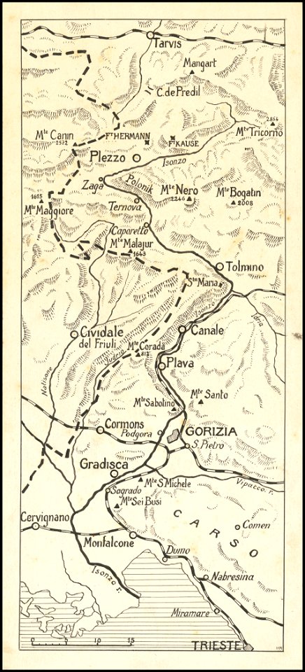
maps of world war i - italian front
hand-drawn maps and views of world war i battlefields by h.m.
western front maps of world war i
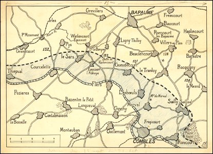
hand-drawn maps and views of world war i battlefields by h.m.
western front maps of world war i
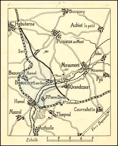
hand-drawn maps and views of world war i battlefields by h.m.
western front maps of world war i
hand-drawn maps and views of world war i battlefields by h.m.
maps of world war i - italian front
engravings by matthäus merian
engraved maps
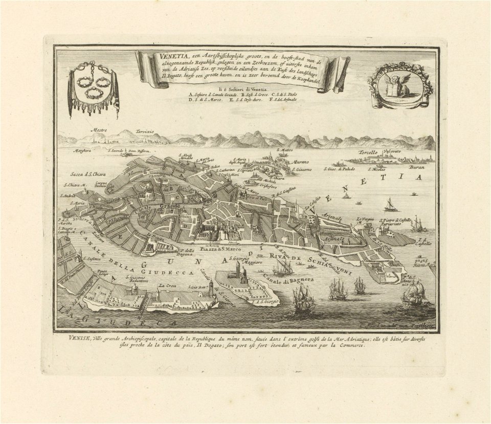
old maps of venice
carolus allard
historical images of lüneburg
maps by matthäus seutter
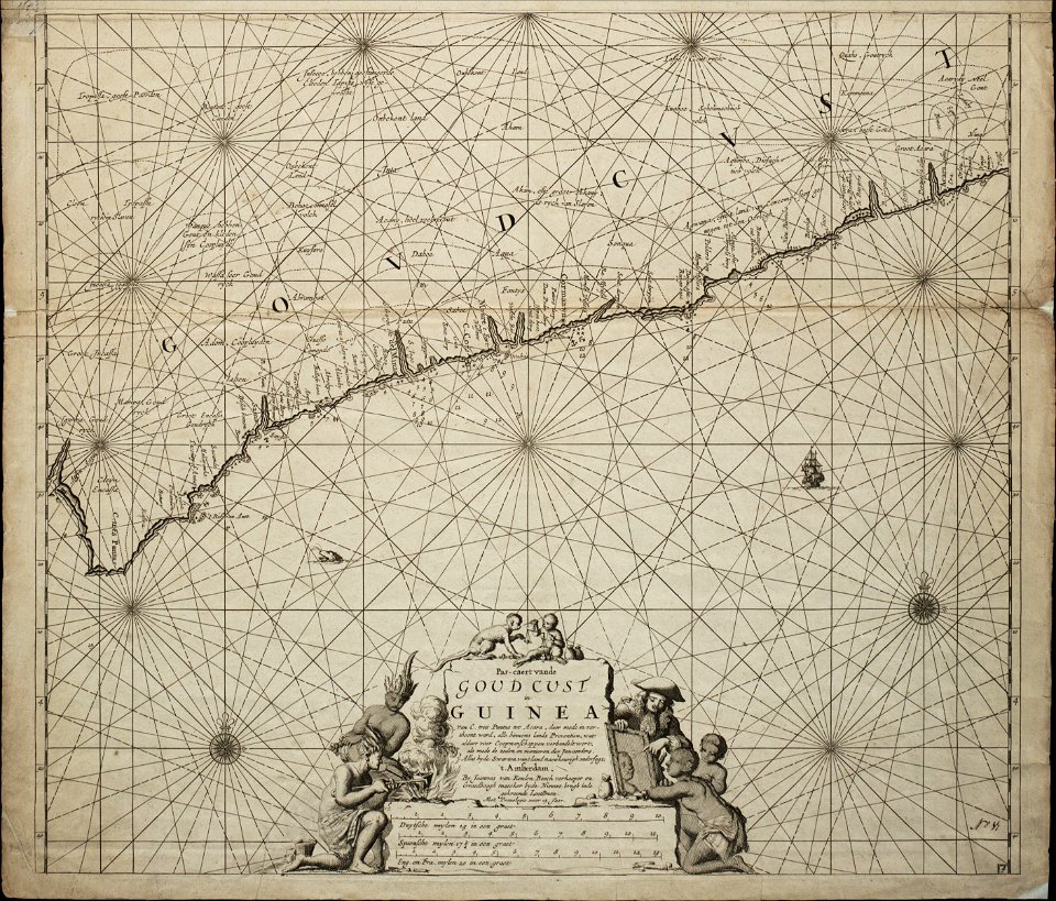
18th-century maps of africa
engravings by jan luyken
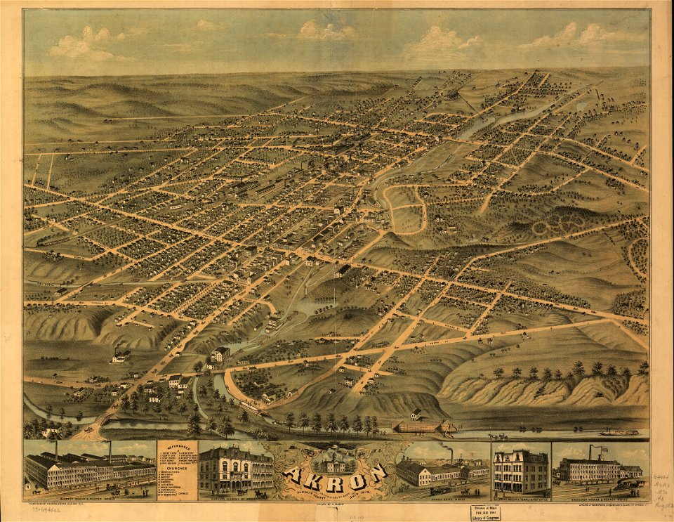
akron
ohio
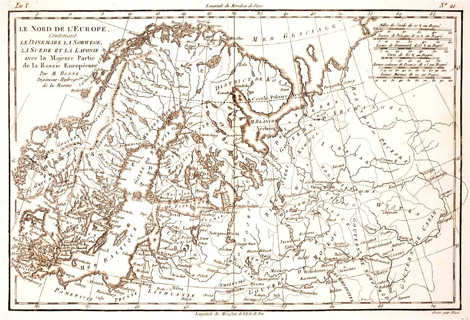
1780 maps of finland
1780 maps of norway
copper engraving
beavers in art
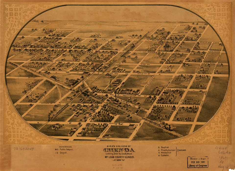
illinois
chenoa
illinois
chenoa
maps with cartouches
atlas van der hagen
maps with cartouches
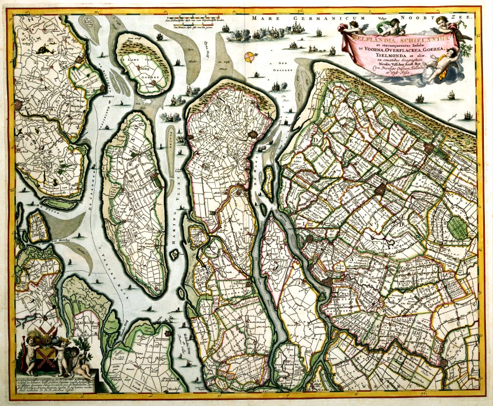
old maps of zeeland
19th-century maps of africa
maps with figures
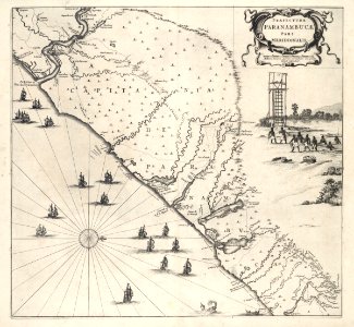
17th-century maps of brazil
old maps of pernambuco
old maps of the dutch east india company
1753 maps
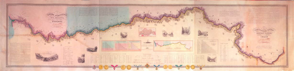
joseph james forrester
port wine
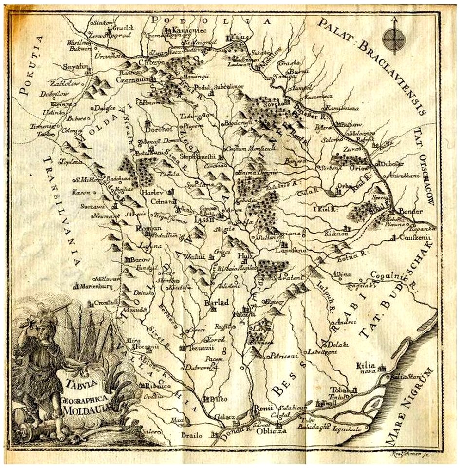
old maps of romania
old maps of moldova
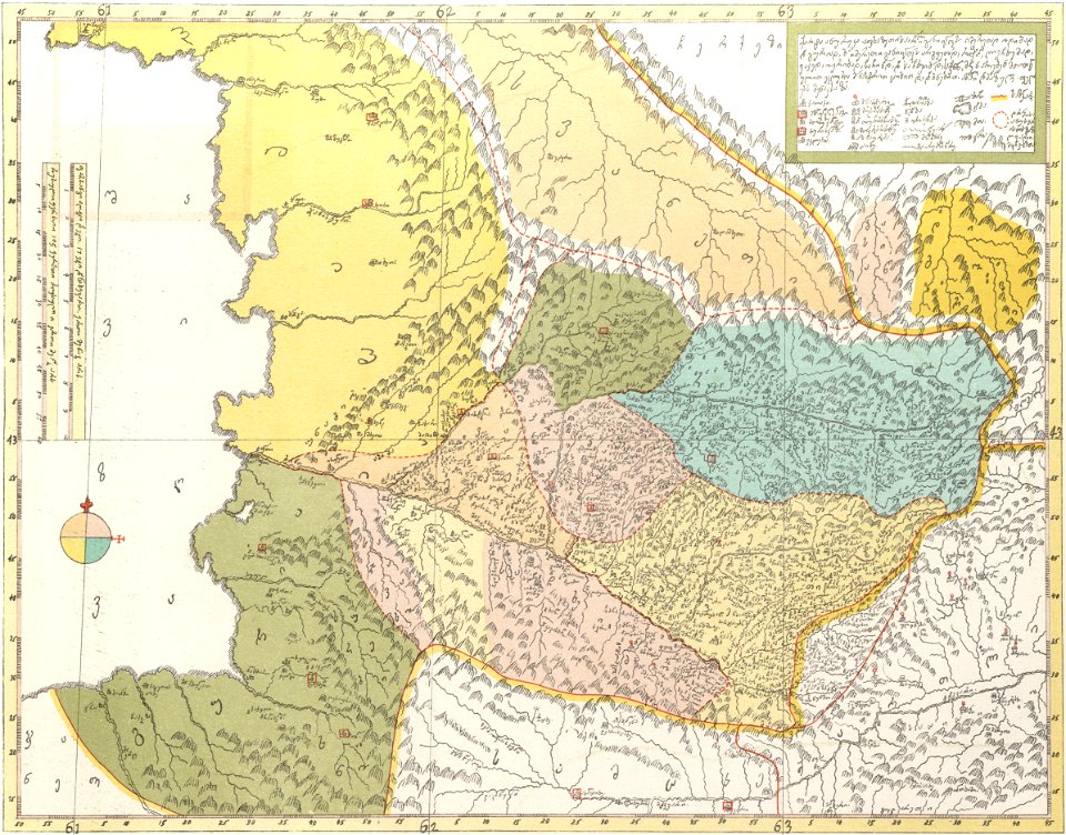
description of kingdom of georgia
its habits and canons
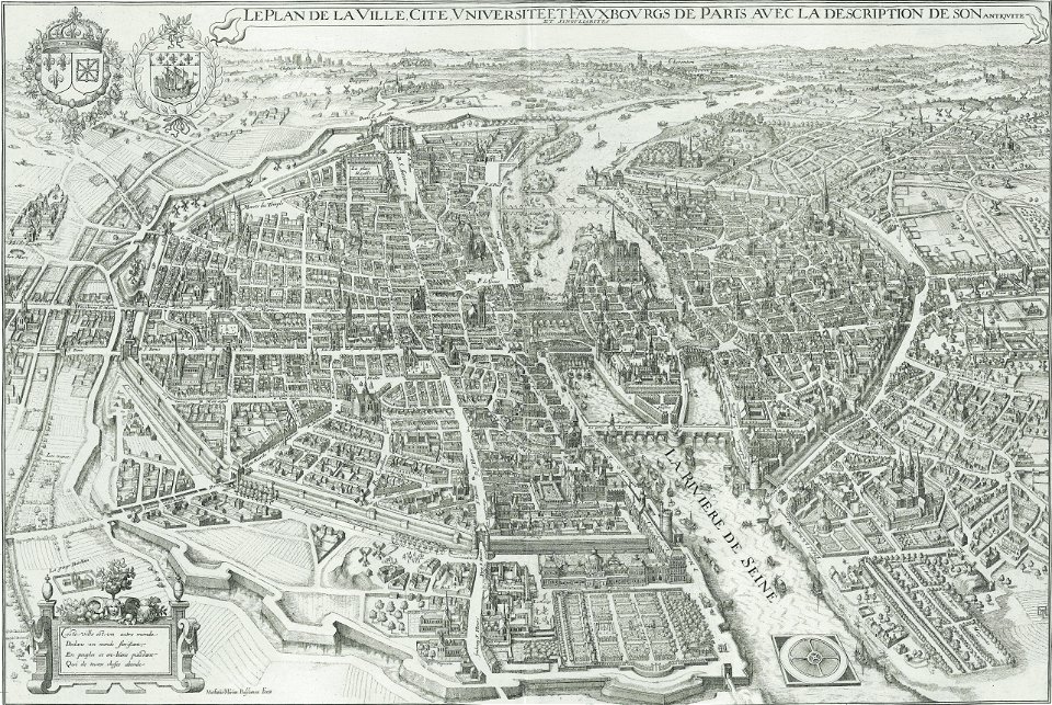
bird's eye view maps of paris
pictorial maps of paris
david rumsey historical map collection
german-language maps
david rumsey historical map collection
german-language maps
david rumsey historical map collection
old maps of the middle east
david rumsey historical map collection
german-language maps
old maps of the atlantic ocean
maps of the north atlantic
cornell university library
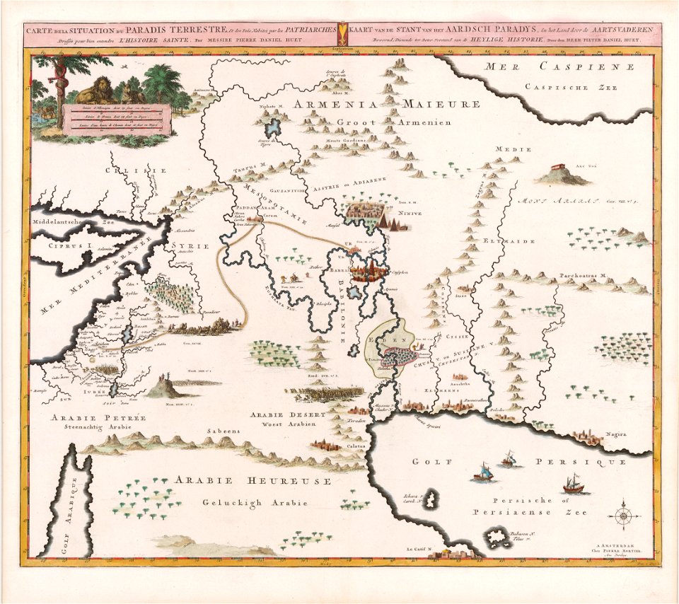
garden of eden
christopher columbus
ferdinand magellan
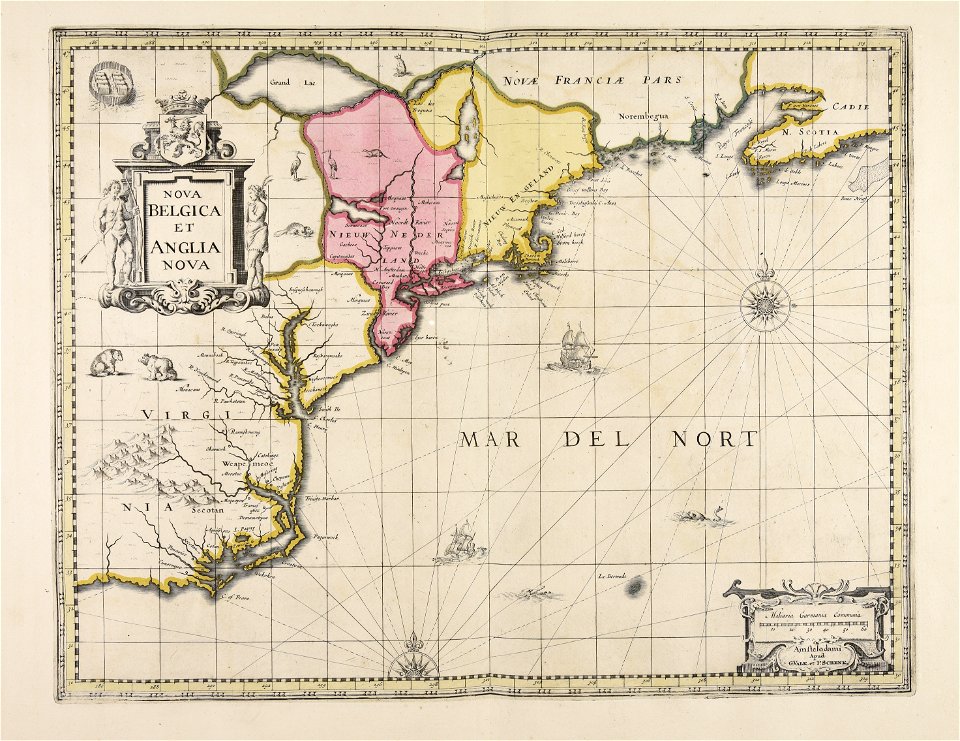
maps by willem and johannes blaeu
ravelins
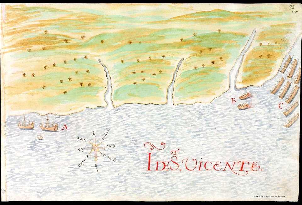
history of saint vincent and the grenadines
pictorial maps
old maps of the arctic
maps in literature
david rumsey historical map collection
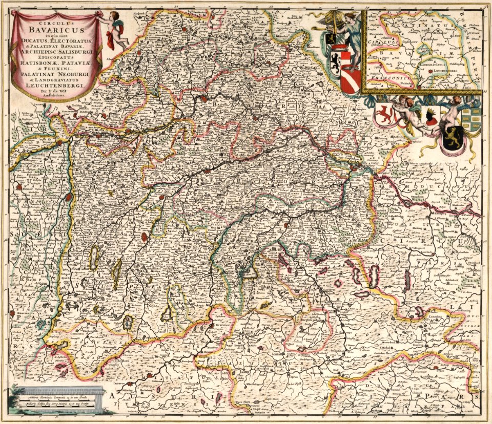
maps by frederick de wit
maps made in the 17th century
gerard valck
maps made in the 17th century
gerard valck
fires in new york (state)
new york city
old maps of new york (state)
new york
old maps of new york (state)
new york city
maps from the mechanical curator collection
1800s maps of palestine
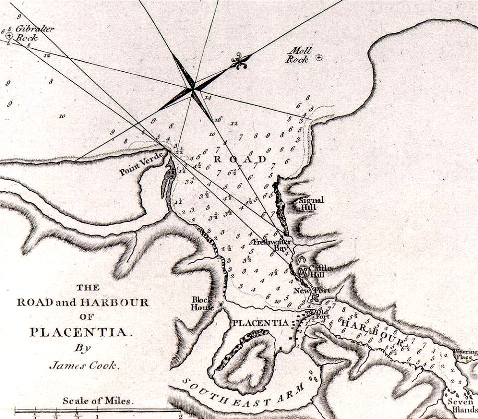
james cook (maps relating to)
old maps of newfoundland
description de l'universe
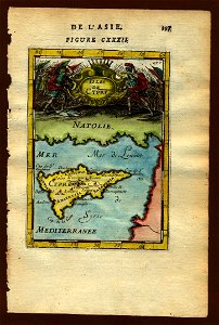
old maps of cyprus
topographic maps of palestine
jerusalem
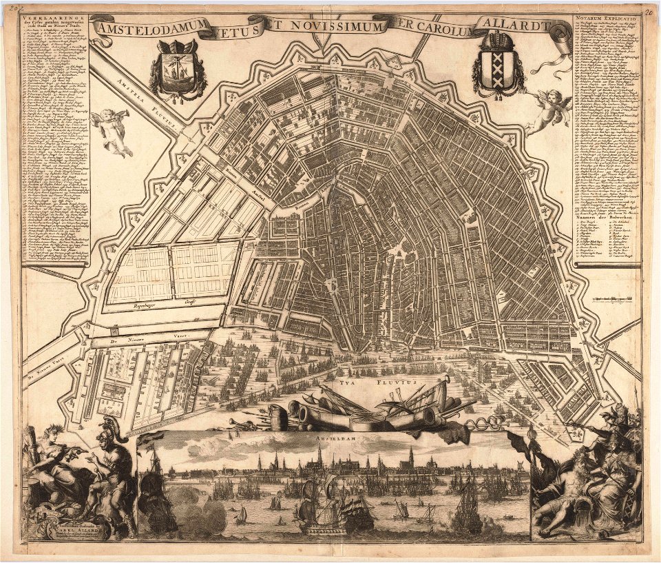
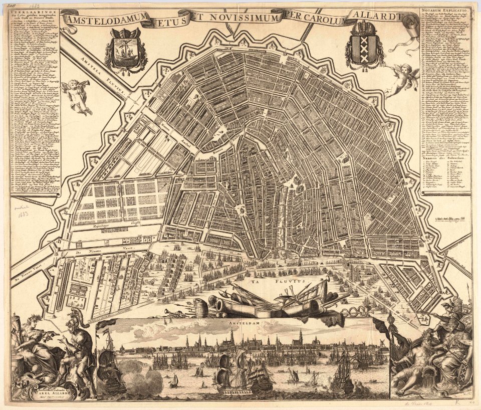
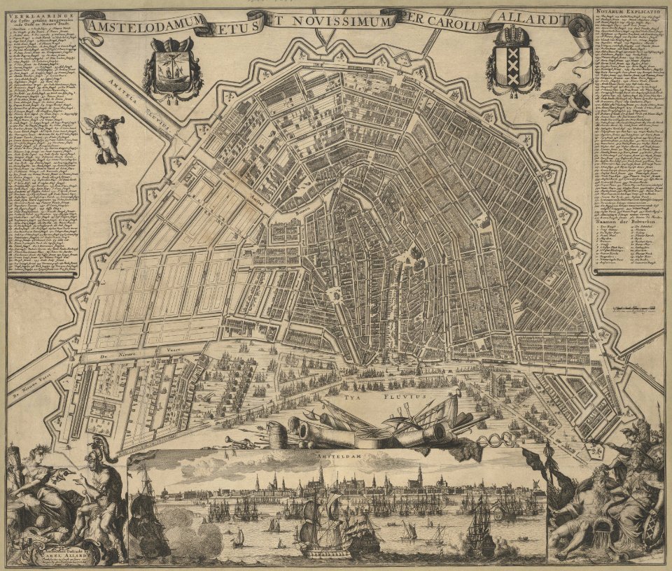
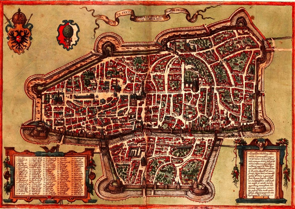
maps in the stadsarchief amsterdam
carolus allard
maps in the stadsarchief amsterdam
carolus allard
maps in the stadsarchief amsterdam
carolus allard
maps in the stadsarchief amsterdam
carolus allard
old maps of saxony
1760 maps
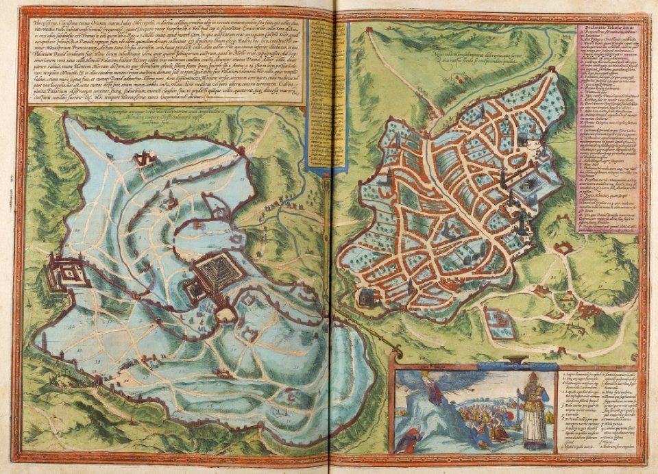
braun & hogenberg
1572 maps
maps with cartouches
braun & hogenberg
carolus allard
1696 maps
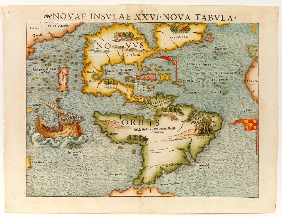
1490s maps of the world
hartmann schedel
maps of the netherlands
fortification
18th-century maps of the americas
elementarwerk
18th-century maps of liguria
old maps of corsica
1570s maps of the world
tommaso porcacchi
1570s maps of the world
tommaso porcacchi
old maps of croatia
1579 maps
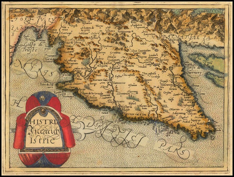
old maps of istria
1579 maps
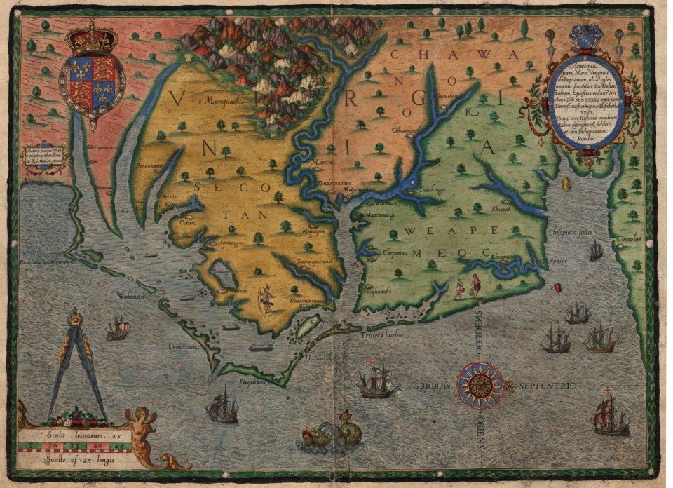
old maps of virginia
theodor de bry
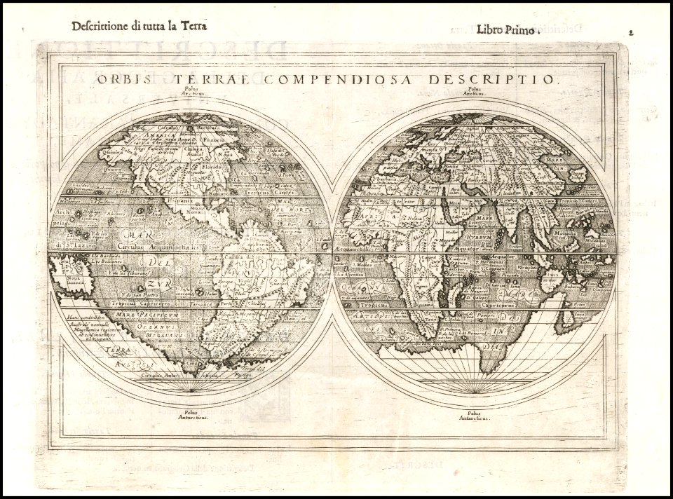
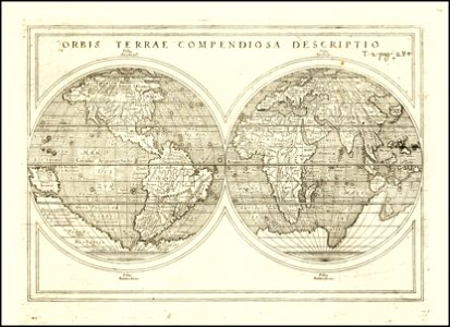
1590s maps of the world
giuseppe rosaccio
1590s maps of the world
giuseppe rosaccio
old maps of papua new guinea
maps of bougainville
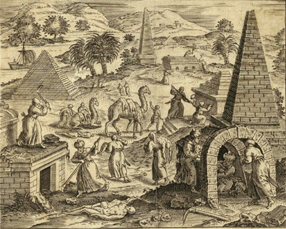
camels in art
1590 maps
collections of staatsbibliothek bamberg
1602 maps
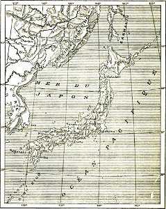
french-language maps
old maps of japan
matthäus merian
1672 maps
nikolskoe (berlin)
1837 maps
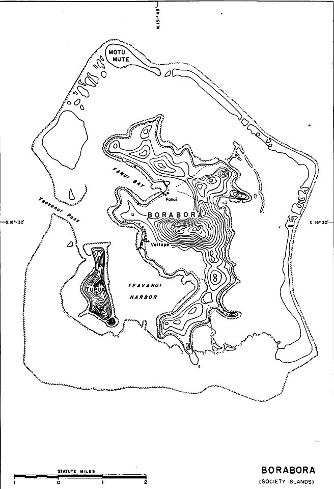
old maps of french polynesia
maps of bora bora
maps of polders in north holland
maps of haarlemmermeer
old maps of the community of madrid
1868 maps
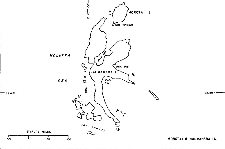
old maps of indonesia
halmahera
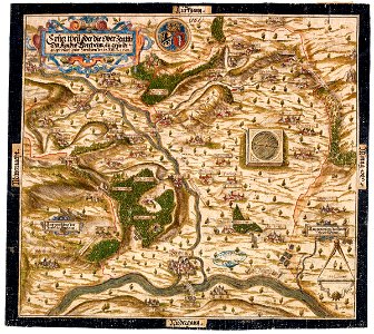
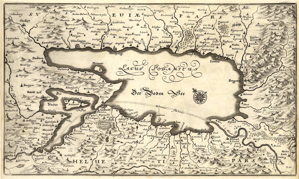
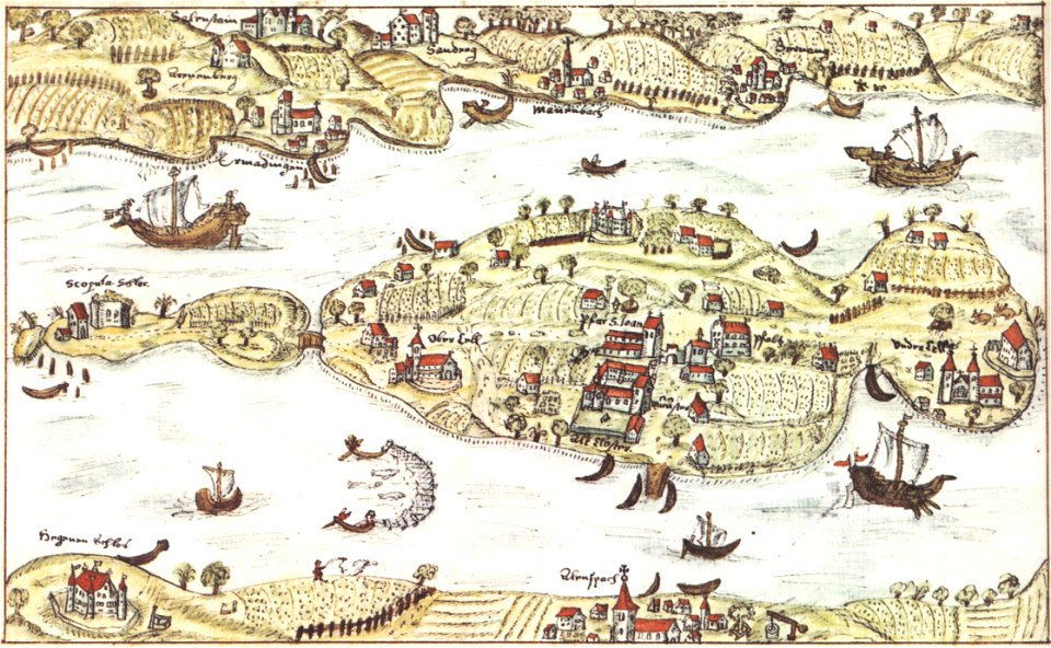
reichenau island
1627 maps
jacques-nicolas bellin
1764 maps
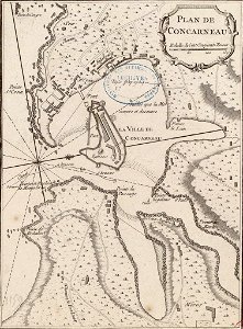
old maps of toulon
toulon naval base
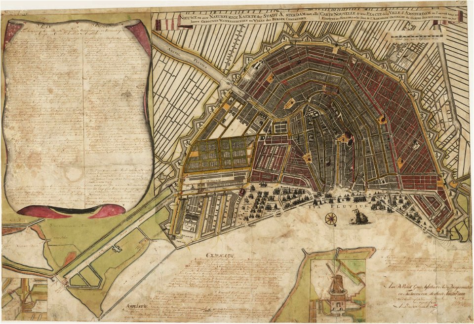
maps in the stadsarchief amsterdam
old maps of amsterdam
1876 maps
lemuria
james cook (maps relating to)
old maps of newfoundland
3101 - 3200 of 863,826
Next page
/ 8639